A developer recently cut into a hillside above Fitzroy to make way for a new subdivision. Within weeks, slumping appeared near the top of the cut. The culprit wasn't just the rain. It was a layer of weathered tephra, invisible from the surface, that lost strength when exposed. In New Plymouth, the ground beneath your feet carries a long volcanic history. The ring plain of Taranaki Maunga is built from alternating layers of andesitic ash, lahar deposits, and soft sandstone. Each layer behaves differently under load. Our team at Sondajes PT models these conditions using limit equilibrium and finite element methods. For sites near the coast, we often pair this with a CPT test to map continuous strength profiles in the ash layers. On larger earthworks, understanding the interplay between tephra and groundwater becomes critical. That's where a targeted investigation saves both time and budget.
A slope in New Plymouth doesn't fail because of one thing. It fails where the tephra meets the sandstone and the groundwater sits.
Methodology and scope
Local considerations
The coastal humidity and frequent storms in Taranaki create a unique acceleration of weathering. Volcanic ash absorbs moisture rapidly. A stable cut in March can become a hazard by July. The recent severe weather events hitting the North Island have pushed many older slopes past their design thresholds. We've inspected sites along the Waiwhakaiho River corridor where toe erosion triggered progressive failures. The biggest risk isn't always the deep-seated landslide. It's the shallow, rapid flow slide in unsaturated tephra. That material collapses without much warning. Our analysis explicitly models suction loss during prolonged rainfall. We use transient seepage analysis coupled with slope stability to capture this mechanism. For coastal properties, the combination of wave undercutting and heavy rain demands a solid monitoring plan. We specify inclinometers and piezometers to validate the design assumptions. A desktop study alone won't cut it here. The ground demands observation.
Applicable standards
NZGS Guidelines for Slope Stability Assessment, NZS 1170.5:2004 (Seismic Actions), Eurocode 7 (EN 1997-1:2004) – NZ Annex, FHWA-NHI-05-123 (Soil Nail Walls)
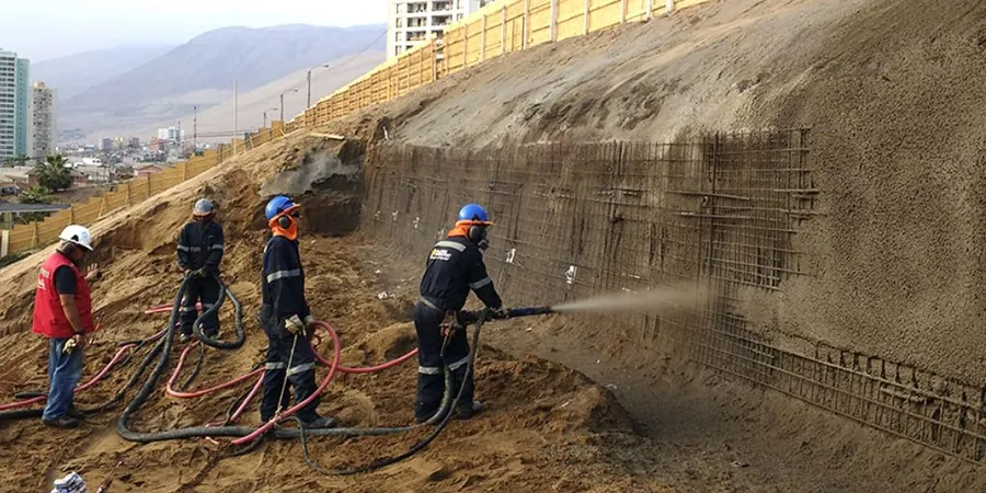
Associated technical services
Field Mapping and LiDAR Interpretation
Detailed engineering geological mapping of the site and surrounding area. We use regional LiDAR to identify paleo-landslides and drainage patterns buried under vegetation.
Drilling and Inclinometer Installation
Cored boreholes through the critical tephra-sandstone interface. Inclinometers are installed to detect the depth and rate of movement during the wet season.
Laboratory Strength Testing
Multistage triaxial and ring shear tests on saturated tephra samples. We focus on residual strength parameters for materials that have already moved.
2D and 3D Limit Equilibrium Analysis
We build models in Slide and Slide3 that replicate the complex layering of the Taranaki ring plain. The analysis covers static, seismic, and rapid drawdown scenarios.
Typical parameters
Frequently asked questions
How much does a slope stability analysis cost for a single residential section in New Plymouth?
For a single residential site, a complete stability assessment—including site inspection, hand auger sampling, laboratory testing, and a written report—ranges from NZ$2,150 to NZ$4,500. If drilling machinery is required to reach deeper failure surfaces, the cost can extend toward NZ$7,070.
What makes the volcanic soil in New Plymouth so tricky for cut slopes?
The andesitic tephra layers are highly moisture-sensitive. They can stand vertically when dry but lose cohesion rapidly when saturated. In New Plymouth, the high annual rainfall means these soils often operate near their residual strength, making shallow failures common during winter.
Do I need a slope stability report for a building consent in New Plymouth?
If your site has a gradient steeper than 1 in 4 or is within a mapped erosion zone, the New Plymouth District Council generally requires a geotechnical report confirming slope stability. Our reports are prepared in accordance with NZGS guidelines to meet consent conditions.
How long does a typical analysis take?
A standard assessment for a residential lot takes about two to three weeks from the field visit to the final report. If deep drilling or inclinometer monitoring over several months is required, the timeline extends accordingly, as we need to capture the groundwater response after heavy rain.
Can you analyse existing landslides that have already failed?
Yes. We use back-analysis techniques to calibrate the soil strength parameters from a known failure. This gives us extremely reliable input data for designing remedial works like retaining walls or drainage systems to prevent further movement.