The volcanic terrain of New Plymouth, dominated by the andesitic stratovolcano of Mt Taranaki, conceals a complex subsurface of lahar deposits, ash layers, and marine terrace sediments. With peak ground accelerations defined by NZS 1170.5 and a city population exceeding 87,000, the transition from firm ignimbrite near the port to softer alluvium in the Waiwhakaiho floodplain creates significant contrasts in site response. A proper seismic microzonation study maps these changes by integrating direct CPT testing for continuous profiling in soft soils and MASW surveys for shear-wave velocity models. The work follows the NZGS Module 4 guidelines for seismic site classification, ensuring each zone reflects actual ground behaviour rather than broad-brush assumptions.
A VS30 value of 180 m/s versus 360 m/s changes your site class from D to C—and your design base shear by a factor of 1.5.
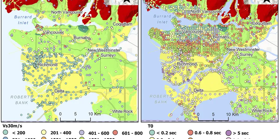
Methodology and scope
Local considerations
The intersection of high rainfall—New Plymouth averages 1,400 mm annually—and volcanic soils creates a scenario where saturation amplifies seismic risk. Soft, water-laden ash layers between stiffer lahar units can trap shear waves, producing resonance effects that standard code spectra miss unless microzonation is performed. Projects near the Huatoki Stream or within the CBD grid face additional complexity from variable fill and legacy foundations. Without site-specific data, a designer might assume Site Class C across the board, missing pockets of Site Class D or E that attract higher spectral accelerations. The 2016 Kaikōura earthquake, though distant, reminded Taranaki engineers that long-period energy travels efficiently through the Taupo Volcanic Zone, making basin-edge effects a genuine concern for mid-rise structures on the New Plymouth foreshore.
Applicable standards
NZS 1170.5:2004 Structural design actions – Earthquake actions, NZGS Module 4: Seismic Site Classification (2021), NZGS Module 1: Guidelines for Liquefaction Assessment (2016), ASTM D5778-20: Standard Test Method for Performing MASW
Associated technical services
MASW and Refraction Microtremor
Active and passive surface wave methods to derive shear-wave velocity profiles. We use 24-channel arrays and SPAC processing for deep VS profiles beyond 30 m where basin geometry matters.
CPT and SPT Ground Truthing
Cone penetration testing with pore pressure measurement (CPTu) plus standard penetration tests to calibrate velocity data. Provides soil behaviour type and cyclic resistance for liquefaction runs.
Site Response Analysis
1D equivalent-linear analysis using DEEPSOIL or SHAKE2000. Input motions matched to the New Plymouth seismic hazard spectrum, with modulus reduction curves for local volcanic soils.
GIS Microzonation Maps
Final deliverables as georeferenced maps showing VS30 contours, site class polygons, fundamental period, and liquefaction severity index. Ready for submission with resource consent applications.
Typical parameters
Frequently asked questions
How much does a seismic microzonation study cost in New Plymouth for a typical subdivision?
For a multi-lot subdivision covering 2 to 10 hectares, costs range from NZ$7,180 to NZ$31,030 depending on the number of MASW arrays, CPT soundings, and the level of site response analysis required. A fixed-price proposal follows the desktop review.
What is the difference between a site-specific study and a regional microzonation?
A site-specific study determines the site class for one building footprint using a single borehole or CPT. Regional microzonation covers an entire area—dozens of hectares—by interpolating multiple measurement points to produce VS30 contour maps and zone boundaries suitable for land-use planning.
How long does the fieldwork take in New Plymouth?
Fieldwork for a typical 5-hectare area runs 3 to 5 days. MASW arrays and CPT soundings proceed simultaneously where access allows. Wet weather in Taranaki can add 1 to 2 days, particularly on grassed sites where heavy CPT trucks need tracking protection.
Can microzonation reduce my foundation costs?
The reference range for this service in New Plymouth is NZ$7.180 - NZ$31.030. The final price depends on the project scope and volume.